GPS mapping helps arborists, land managers, and urban planners precisely document the location, health, and characteristics of trees and forested areas. This technology is invaluable for making informed decisions about tree maintenance, protection, and long-term management. It is particularly useful in Remediation Planning as a method of tracking the changes that trees undergo as a result of remediation work.
What is it used for?
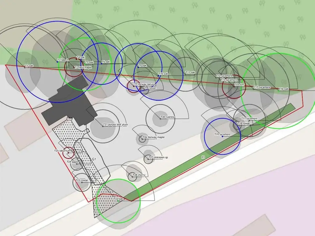
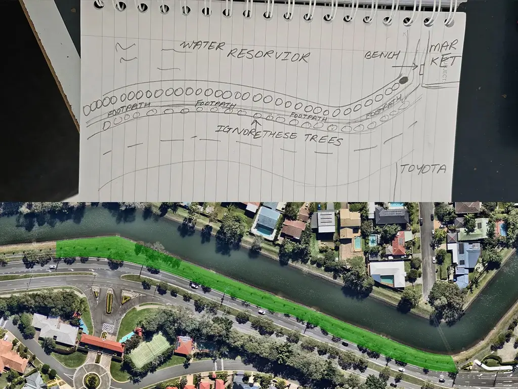
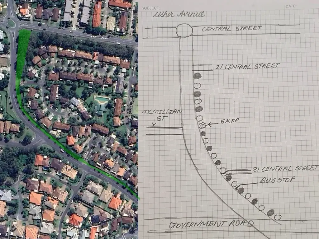
There are several primary uses for GPS mapping, the first of which is tracking and monitoring of both locations and tree health over a period of time. GPS mapping allows arborists to create an accurate, digital map of all trees within a specific area. Each tree’s location is recorded via GPS coordinates and provides a precise location for future reference. Furthermore, when linked to tree care management software information about the tree’s species, size, health, and maintenance history can be recorded and monitored in far higher detail and accuracy.
GPS mapping also further improves tree risk assessments by collecting data on the condition of individual trees such as trunk stability, root health and/or the presence of disease. GPS mapping enables arborists to assess whether a tree poses a risk to either property or person and to take action if they deem it necessary. Additionally, GPS Mapping is also used to identify Tree Protection Zones (TPZs) for site plans and also facilitates in identifying which trees need to be removed and which can be preserved when an area is undergoing development.
Finally, it is also used to monitor environmental changes, and the effects droughts, storms, pollution or climate change have on the health of a specific type of tree or entire populations. Monitoring is especially important in areas that experience rapidly changing environments as it can guide specialists when it comes to performing interventions such as watering, pest control or many other services.
GPS mapping in tree care is a powerful tool that enhances the accuracy, efficiency, and effectiveness of managing trees and urban forests. It helps tree care professionals and urban planners track tree health, plan for sustainable urban growth, and monitor environmental changes over time.
/